17 November 2008
Weekly activations
“The charter’s main objective is to obtain a satellite image of a disaster area as quickly as possible,” says André Husson, who sits on the Board of the International Charter on Space and Major Disasters.
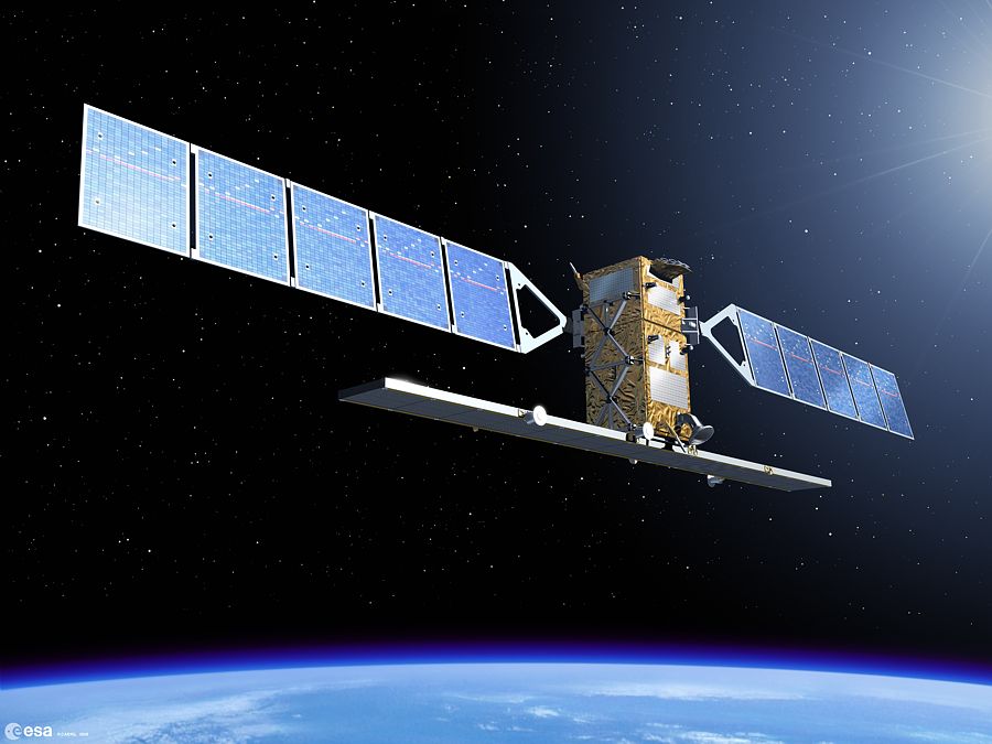
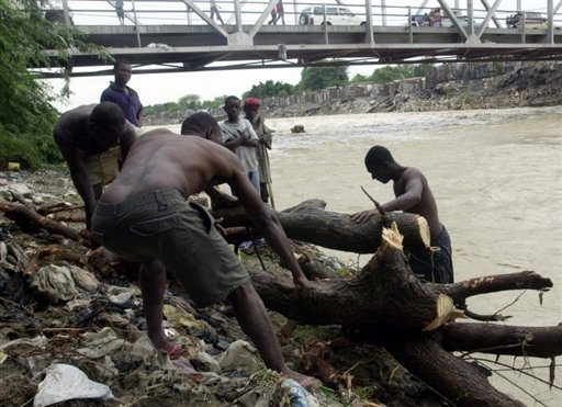
As soon as the charter receives an alert, its 9 signatory space agencies* task their satellites and domain experts to deliver urgent satellite imagery to disaster-affected nations. “This imagery allows emergency response teams to assess the damage and locate survivors who need help, adds André Husson.
Events for which the charter has been pressed into action this year include the violent earthquake in China in May, Hurricane Gustav in the West Indies and more recently floods in Vietnam. In the last 8 years, the charter has been activated 198 times. “The charter is being activated more and more often, once a week on average,” notes André Husson.
But the signatories have no intention of being overwhelmed by the charter’s success. Member space agencies chair the charter on a rotating basis to manage daily activities and optimize its working mechanisms. CNES recently took over the helm from the Canadian Space Agency and will be chair until April 2009.
Quicker response
To make the charter more responsive, members recently decided to work with ESA’s SaVoir programme (Swath Acquisition Viewer). Their aim is to see at a glance where satellites are around the globe and identify those positioned to picture affected areas in the event of a disaster.

Through SaVoir, the charter’s domain experts hope to shorten satellite tasking and image acquisition times. Today, these operations take 1 or 2 days.

During its term as charter chair, CNES will be studying the request from the Group on Earth Observations (GEO), which encompasses 73 member nations and international organizations, and from Google Earth to be allowed to activate charter assets directly. The U.S.-based geoportal would like to distribute data from the charter.
“The idea is appealing, as it would raise the charter’s profile,” says André Husson. “But we need to check certain legal implications first, particularly with regard to ownership of imagery.”
“The idea is appealing, as it would raise the charter’s profile,” says André Husson. “But we need to check certain legal implications first, particularly with regard to ownership of imagery.”
* The 9 charter members are ESA, CNES (France), CSA (Canada), NOAA/USGS (USA), ISRO (India), CONAE (Argentina), JAXA (Japan), BNSC/DMC (United Kingdom) and CNSA (China)
Voir aussi
The International Charter on Space and Major Disasters Website
ESA Website
ASC Website(Canadian Space Agency)
ISRO Website(Indian Space Research Organisation)
NOAA Website (National Oceanic and Atmospheric Administration)
CONAE Website (Argentina Space Agency)
JAXA Website (Japan Aerospace eXploration Agency)
BNSC Website (British National Space Center)
ESA Website
ASC Website(Canadian Space Agency)
ISRO Website(Indian Space Research Organisation)
NOAA Website (National Oceanic and Atmospheric Administration)
CONAE Website (Argentina Space Agency)
JAXA Website (Japan Aerospace eXploration Agency)
BNSC Website (British National Space Center)